SQUALL WARNINGS AIM TO AVOID UNVANTED IMPACT OF ADVERSE WEATHER
Particularly during the summer months we may experience intense showers with torrential rain or even hail, often accompanied by sudden strong winds, lightning, and thunder. Such weather conditions can develop relatively quickly, and the resulting storm can therefore arrive unexpectedly. The sudden change and adversity of such weather can pose safety risks for critical operations and challenges for critical infrastructure and public services.
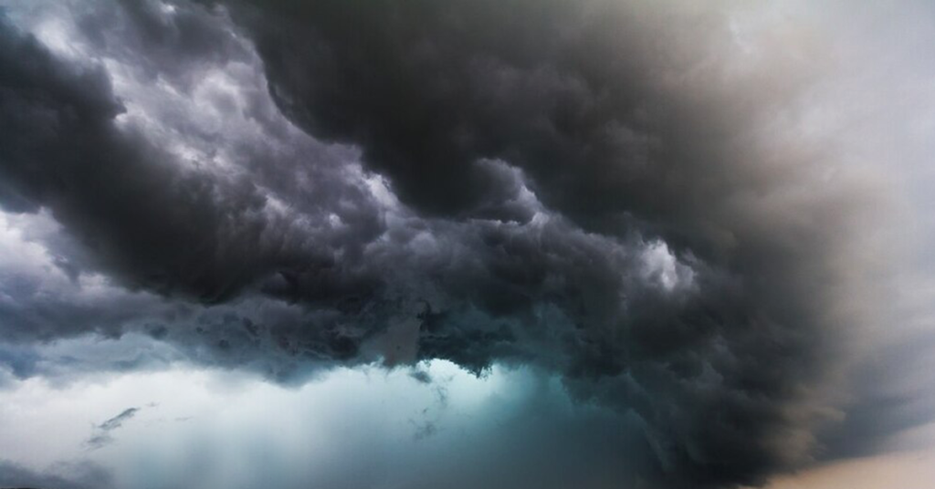
Storm cells that typically will issue a squall warning.
A squall warning can be issued to inform relevant authorities and the general public about sudden and adverse weather, characterized by a significant increase in wind speed, often accompanied by lightning and thunder, and substantial precipitation in the form of torrential rain, hail, or snow.
Operational principle of FURUNO SQUALL WARNING
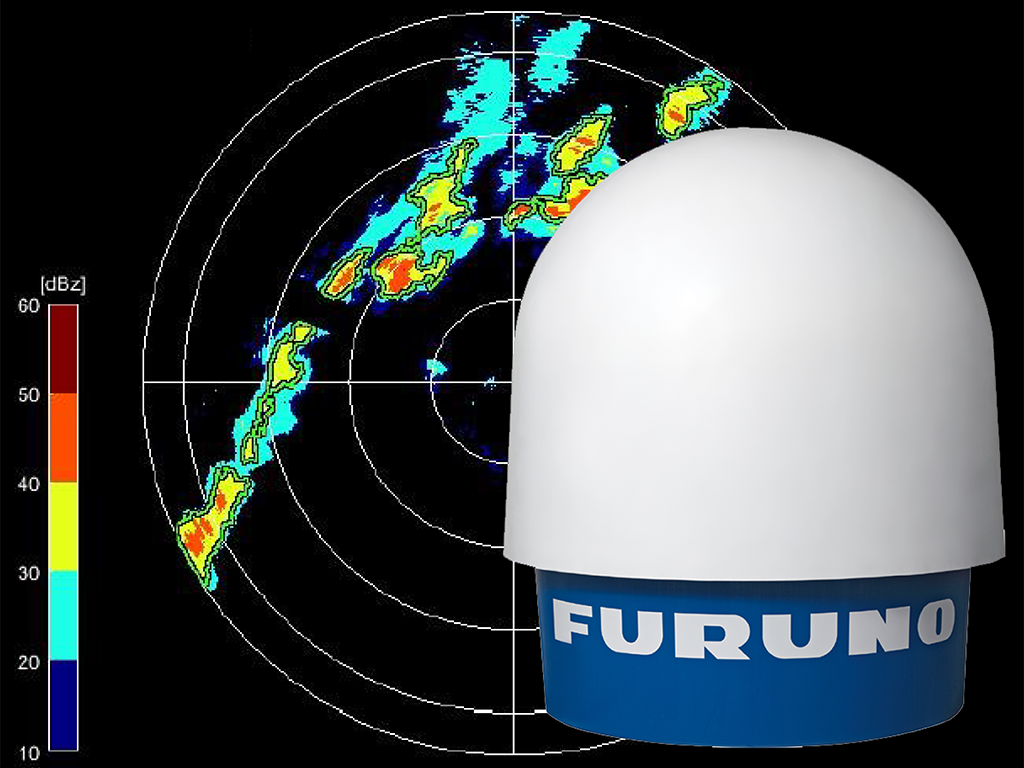
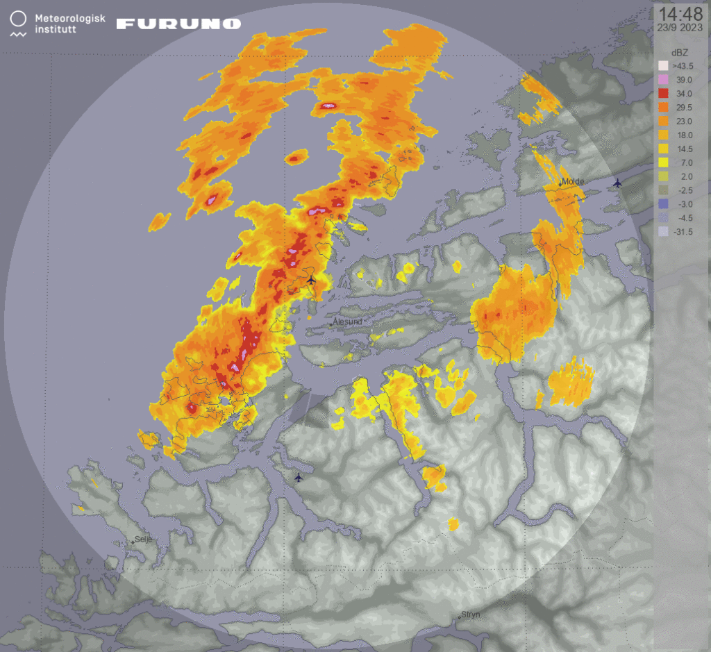
The Furuno Squall Warning System is based on Furuno Weather Radar measurements and analysis. The weather radar continuously generates observational data, which are analysed every 5 minutes.
The radar scans 360° (degrees) azimuth at different elevations in order to measure the precipitation at different heights relative to the horizon. Furuno squall warnings use one elevation selected by the user for analysis. The remaining elevations are saved for reference and made available for later offline analysis.
Conditions forming a Squall warning
The Furuno Squall Warning System uses a combination of two data sets:
- Reflectivity - Reflectivity is a measure for the microwave reflection from hydrometeors back to the radar. The size of reflection is dependent on drop size and precipitation type (liquid, snow, ice, hail or a combination).
- Doppler velocities - The Doppler velocity is measured as the radial velocity of the hydrometeors. It indicates the movement along the scan line of every radar beam.
The Squall Warning System issues squall warnings when a number of conditions are met:
- The reflectivity or Doppler velocity is above a certain threshold
- The cells must form the structure of a line with a linearity of 0.75
- The squall line must have a minimum length of 20 kilometres
- The cells forming the squall line can be no more than 5000 meters apart
- The squall line should be persistent for at least 10 minutes
Even though a squall waring has not been issued, it is recommended to carefully observe the velocity and reflectivity levels. Even though storm cells are not part of a squall line, they may still cause high winds and low visibility.

Four customizable warning levels
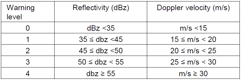
The four warning levels can occur in different combinations. The values listed in the below table are default values that can be adjusted according to local conditions and experience.
How to understand the Squall warning
In the following example the Furuno Weather Radar with the Squall Waring System is installed on a ship, placed at the centre of the radar image. North is up. The images are automatically refreshed every 5 minutes.
The rings illustrates the distance from the ship in 6, 12, 18, 24 and 27 nautical miles (NM). The outermost ring visualises the detection range for the radar. Precipitation fields detected outside this range do not have sufficient accuracy to be part of the analysis.
To the left of the on-screen presentation there is a panel with key information. The general information comprises the maximum radar reflectivity and Doppler velocity from the whole detection range.
Beneath this section there is either an indication of Squall Warning or No Warning. The following information is key information from the system’s squall identification process, such as ETA, Direction, Distance and Speed.
In the lover panel, the reflectivity and Doppler velocity from the last 30 minutes are illustrated with an animated GIF, providing a visual impression of the size, speed, direction and intensity of a squall.
The radar reflectivity colour scale presents the storm cell's intensity measured in dBz. The Doppler velocity is presented as speed measured in meters per second.


 Norsk
Norsk
